


Latest Version
Version
1.0
1.0
Update
July 19, 2025
July 19, 2025
Developer
Ian Lochhead
Ian Lochhead
Categories
Travel & Local
Travel & Local
Platforms
Android
Android
Downloads
0
0
License
$0.99
$0.99
Package Name
appinventor.ai_ianlochhead1994.Birmingham_Ian
appinventor.ai_ianlochhead1994.Birmingham_Ian
Report
Report a Problem
Report a Problem
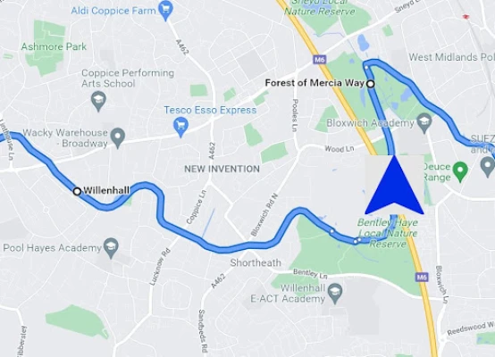
More About Satnav Cycle Routes-Birmingham
Three Satnav Cycle Routes around Birmingham using cycle paths and roads.
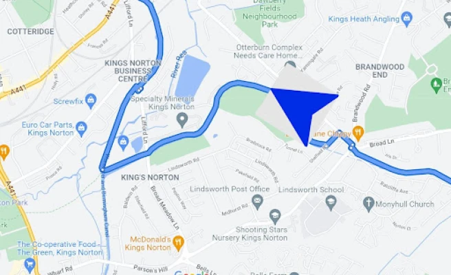
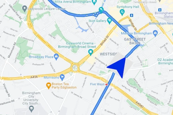
1. Birmingham to Kings Norton – 20 miles
2. Birmingham to Sutton Coldfield – 24 miles
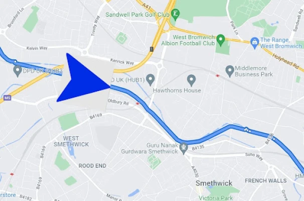
3. Birmingham to Wolverhampton – 35 miles
Every route has turn-by-turn navigation with voice instruction. Enjoy the benefits of cycling a whole route by following Sat Nav instructions without having to buy an expensive Sat Nav. Just download the app to your device.
Using Satnav Cycle Routes means that you no longer have to use paper maps when you try new cycle routes. Even if you take a wrong turn the app will quickly work out a new route on your device to get you back on track. The routes are all graded to give you an idea of how easy or difficult they are. You are also advised which type of bike the routes are suitable for, the type of terrain and the length. The routes are not all traffic-free but use paths as much as possible together with quiet roads.
All of the routes are circular and start and end at the free car park at Edgbaston Reservoir at the end of Reservoir Road, Birmingham.
2. Birmingham to Sutton Coldfield – 24 miles
3. Birmingham to Wolverhampton – 35 miles
Every route has turn-by-turn navigation with voice instruction. Enjoy the benefits of cycling a whole route by following Sat Nav instructions without having to buy an expensive Sat Nav. Just download the app to your device.
Using Satnav Cycle Routes means that you no longer have to use paper maps when you try new cycle routes. Even if you take a wrong turn the app will quickly work out a new route on your device to get you back on track. The routes are all graded to give you an idea of how easy or difficult they are. You are also advised which type of bike the routes are suitable for, the type of terrain and the length. The routes are not all traffic-free but use paths as much as possible together with quiet roads.
All of the routes are circular and start and end at the free car park at Edgbaston Reservoir at the end of Reservoir Road, Birmingham.
Rate the App
Add Comment & Review
User Reviews
Based on 0 reviews
No reviews added yet.
Comments will not be approved to be posted if they are SPAM, abusive, off-topic, use profanity, contain a personal attack, or promote hate of any kind.


More »

Popular Apps
Total Connect ComfortResideo Technologies, Inc.

12 Labours of Hercules XVIIIJetDogs Oy
Sygic GPS Navigation & MapsSygic.

MobileDDx™ Pocket DDx ToolSkyscape Medpresso Inc

Access MoreAccess Bank plc

Fanable - Collectibles StoreEthernal Labs Inc.

Grace to YouGrace to You

Microsoft OneDriveMicrosoft Corporation

SaGa SCARLET GRACE : AMBITIONSSQUARE ENIX Co.,Ltd.

Android Accessibility SuiteGoogle LLC
More »
Editor's Choice

H BandShenzhen Veepoo Technology Co., Ltd.

Hand in Hand 1e-future

Hand Talk Translator for ASLHand Talk

Plant App - Plant IdentifierScaleUp

Everybody ReformerBranded MINDBODY Apps

EveryBody BookingFit Pro Tracker Company

Honestly: Wellbeing CoachingRefaceLithuania

EarnIn: Why Wait for Payday?Activehours Inc.

SimplyBook.me adminsimplybook

Visiting AidVisiting Aid, LLC